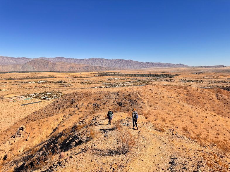
Popular Hiking Trails in Anza-Borrego Desert
Share
Explore the Best Hikes Across Anza-Borrego
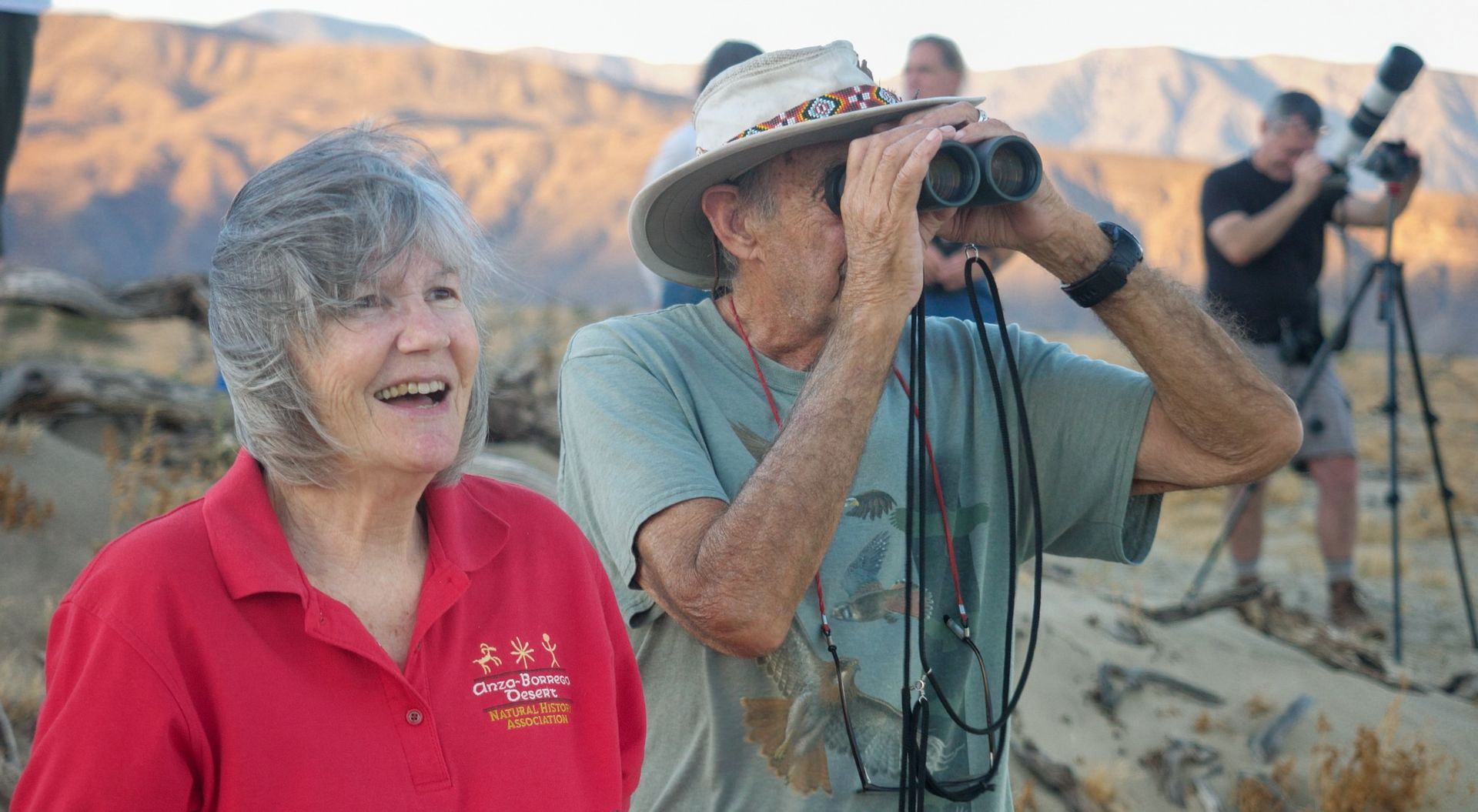
For guided hikes, check out the Anza-Borrego Foundation and ABDNHA.
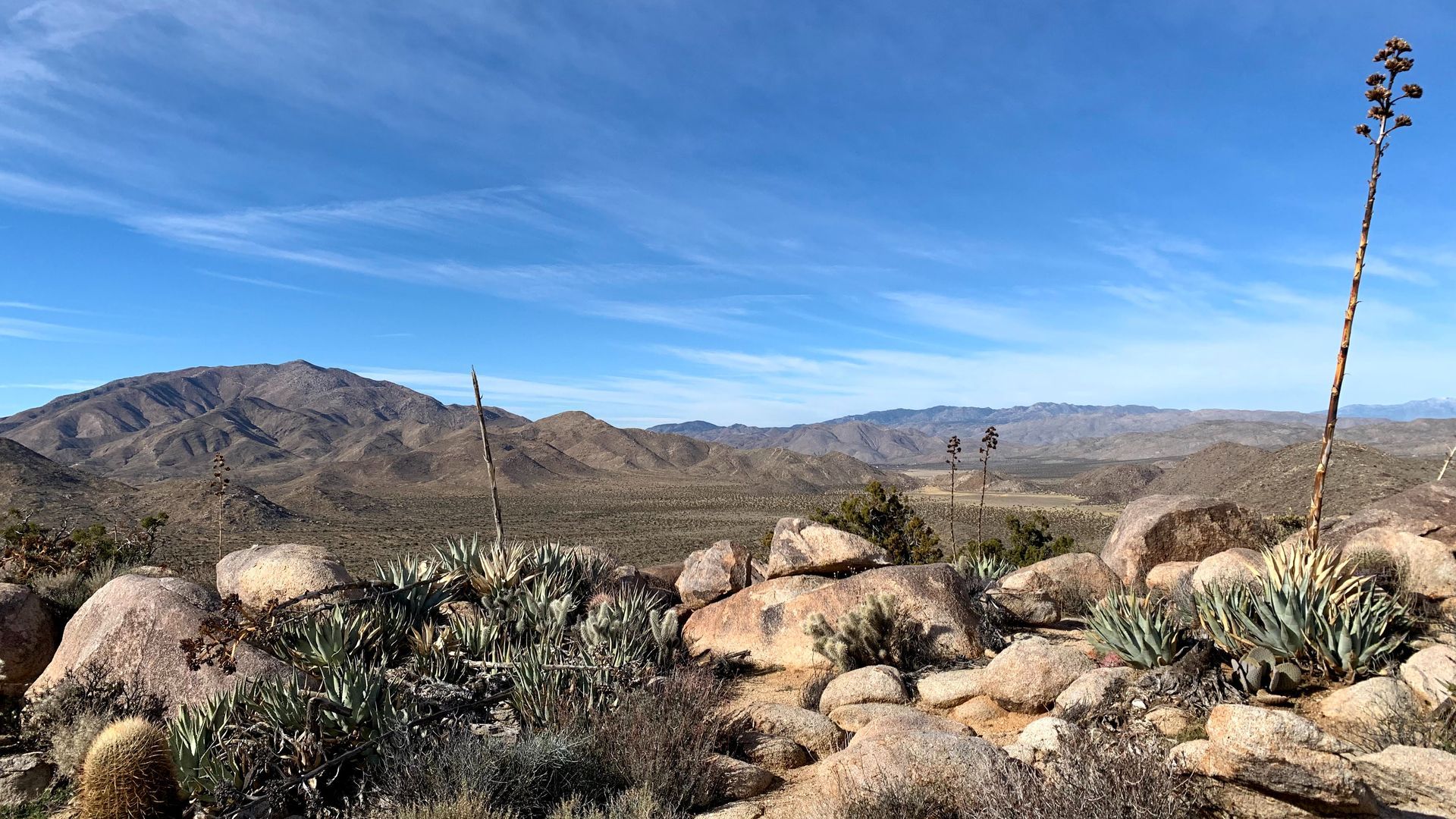
Anza-Borrego Desert State Park offers a diverse range of hiking trails that showcase the beauty of California's largest state park. From scenic palm oases to rugged mountain summits and historic homesteads, there’s something for every type of adventurer.
Here’s a guide to the most popular trails, complete with their locations, to help you plan your next desert adventure.
Borrego Palm Canyon Trail
Location: Near Borrego Palm Canyon Campground, west of Borrego Springs.
A 3-mile round-trip hike leading to a stunning palm oasis with seasonal water features. This is one of the park’s most popular hikes, especially during the spring wildflower season.
>> Click to learn more
Hellhole Canyon Trail
Location: Off Montezuma Valley Road (S22), south of Borrego Springs.
A 5.5-mile hike leading to the hidden Maidenhair Falls, surrounded by lush vegetation in contrast to the arid desert. The trail provides a challenging trek with beautiful desert flora along the way.
>> Click to learn more
Coyote Canyon
Location: North of Borrego Springs, accessible via DiGiorgio Road.
This multi-stage hike follows Coyote Creek and leads hikers through palm groves and stream crossings. The canyon is closed to vehicles from June 1 to October 1, but hiking remains an option in the cooler months.
>> Click to learn more
Pena Spring and Goat Canyon
Location: Southern part of the park near Carrizo Gorge.
A more remote and rugged hike that takes you to Pena Spring and offers impressive views of Goat Canyon and the Goat Canyon Trestle, one of the largest wooden railroad trestles in the world.
>> Click to learn more
The Slot
Location: East of Borrego Springs, off Buttes Pass Road.
This short 2-mile hike takes you through narrow, winding canyon walls, offering a fun and unique desert experience. The Slot is famous for its tight passageways and dramatic rock formations.
>> Click to learn more
Fish Creek Wash
Location: Southern area of the park, accessible from Split Mountain Road.
A 6.3-mile hike through the heart of the Fish Creek Badlands, known for its geological formations and fossilized oyster beds. The surrounding rock layers tell the story of the area’s ancient seabed.
>> Click to learn more
Calcite Mine Trail
Location: Off S22 (Borrego-Salton Seaway), northeast of Borrego Springs.
This 4.5-mile trail follows the remnants of old calcite mining operations from World War II. It’s a moderately challenging hike with expansive desert views and fascinating historical significance.
>> Click to learn more
Villager Peak Trail
Location: Eastern side of the park, near Highway 78.
A strenuous 14-mile round-trip hike that takes you up to Villager Peak, offering one of the most panoramic views in the park. The trail is remote and demands a high level of fitness and preparation.
>> Click to learn more
Marshall South Trail (Ghost Mountain)
Location: Near Blair Valley, off the S2 highway in the southern section of the park.
This 1-mile trail leads to the ruins of Marshall South’s homestead, where the poet and author lived with his family in the 1930s and 1940s. The site offers a glimpse into desert homesteading life and spectacular views.
>> Click to learn more
Carrizo Badlands Overlook
Location: Southeast of the park, off the S2 highway.
A short hike to a scenic overlook with breathtaking views of the Carrizo Badlands. This spot offers excellent photography opportunities, especially at sunrise or sunset.
>> Click to learn more
Mountain Palm Springs
Location: Southern part of the park, near Mountain Palm Springs Campground, off S2.
A 3-mile hike through several palm groves nestled in the Carrizo Valley. The trail features diverse desert vegetation and seasonal water sources, making it a great option for nature lovers.
>> Click to learn more
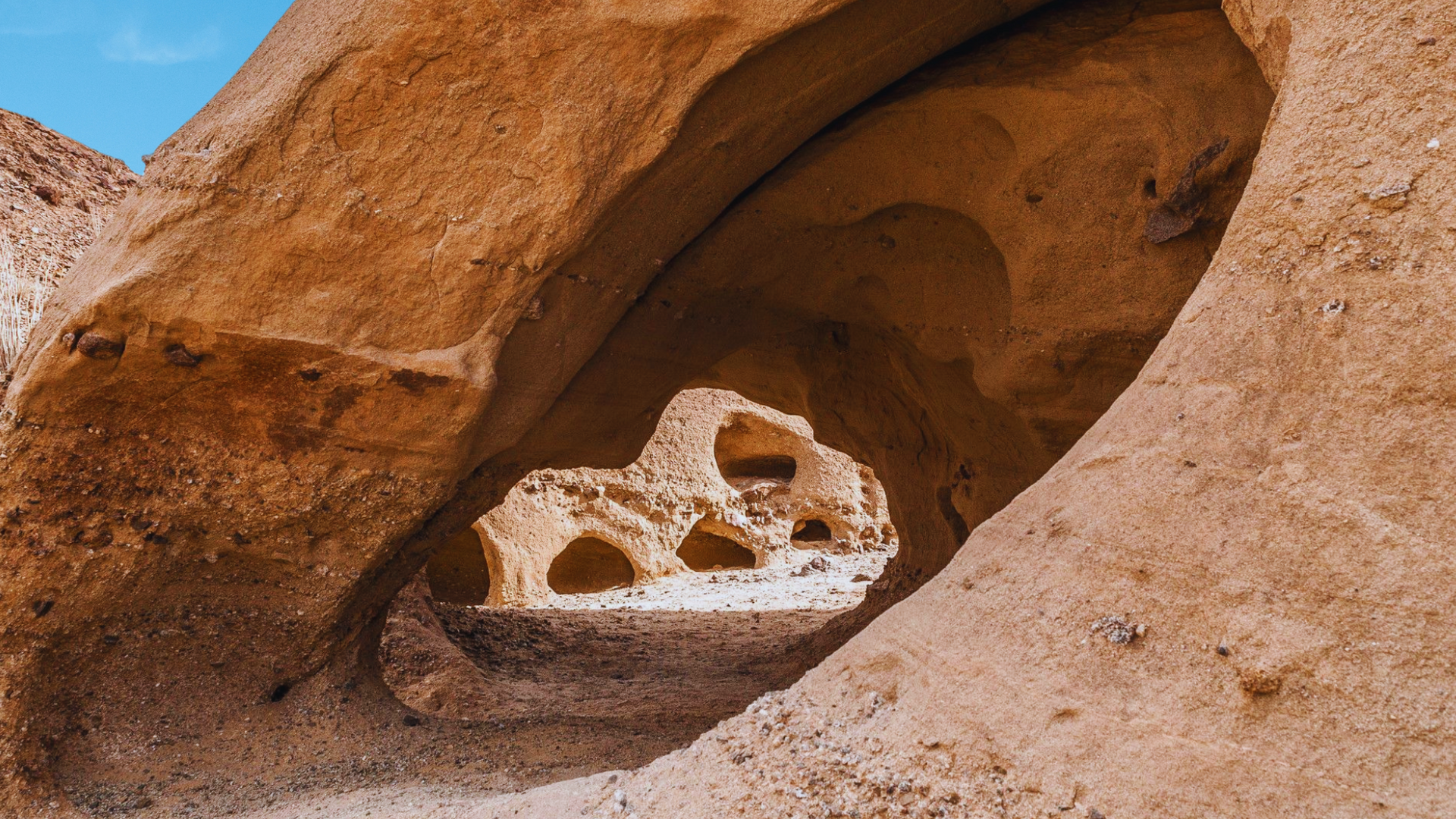
Split Mountain Wind Caves Trail
Location: Split Mountain Road, Southern part of the park.
This trail leads to the Wind Caves, unique sandstone formations shaped by wind erosion, offering panoramic views of the surrounding desert and badlands.
>> Click to learn more

Additional Noteworthy Hikes:
- Yaqui Well Nature Trail
- Location: Across from Tamarisk Grove Campground.
- A 1.6-mile round trip to an historic desert water hole, with plenty of birdwatching and wildlife.
- Cactus Loop Trail
- Location: Across from Tamarisk Grove Campground.
- A moderately strenuous 1-mile loop with great views of the park’s diverse cactus species.
- Bill Kenyon Overlook
- Location: Near Yaqui Pass Campground.
- A 1-mile loop trail offering expansive views of the surrounding landscape.
- Narrows Earth Trail
- Location: Off Highway 78, 4.7 miles east of Tamarisk Grove.
- A short, half-mile trail that provides insight into the park’s fascinating geological formations.
- Pictograph Trail / Smuggler’s Canyon
- Location: Blair Valley, 3.6 miles from Highway S-2.
- A 2- to 3-mile trail that leads to ancient Native American pictographs, with the option to continue into Smuggler’s Canyon for great views of Vallecito Valley.
- Pygmy Grove
- Location: Near Mountain Palm Springs Campground.
- A short, easy 1-mile hike that leads to a grove of short palm trees.
- Palm Bowl
- Location: Near Mountain Palm Springs Campground.
- A 2-mile hike that passes through a large palm grove before reaching Palm Bowl, which is ringed by over 100 palms.
Need More Guidance?
For even more information, tips, upcoming guided hikes, and additional trail maps, we highly suggest reaching out to the Anza-Borrego Foundation (ABF) and the Anza-Borrego Desert Natural History Association (ABDNHA). Both organizations provide invaluable resources for exploring the park.
- Anza-Borrego Foundation (ABF)
- Website: theabf.org
- Location: 587 Palm Canyon Dr # 110, Borrego Springs, CA 92004
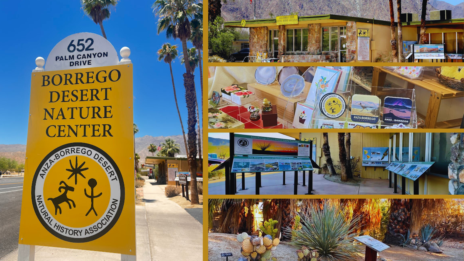
- Anza-Borrego Desert Natural History Association (ABDNHA)
- Website: abdnha.org
- Location: 652 Palm Canyon Dr, Borrego Springs, CA 92004
Both are located in Borrego Springs, making them easy to visit for additional information on how to get the most out of your visit to Anza-Borrego Desert State Park.
>>> Check out OutdoorSocal.com's Anza Borrego Blog Series
Learn More About Borrego Springs & Anza Borrego